Overview
Navigation in the Age of Exploration was underpinned by celestial navigation. Celestial navigation was the practice of fixing positions using measurements and angles between celestial bodies (sun, moon and stars) and the horizon. It required a great deal of skill in the field of mathematics and astronomy and used advanced technologies for the time. As ocean trade and the quest for new discoveries increased, more advanced techniques and technologies were required for ocean voyaging. Endeavour’s voyage into the Pacific was not only for the purposes of navigational discovery in the quest to record the Transit of Venus but also to test new navigational technologies. Advancements in navigational systems are still being made as we continue our explorations of earth and into space.
Key inquiry question:
How did James Cook and other explorers during the Age of Exploration navigate the oceans and chart the land?
1. As a class watch the video Longitude and Latitude Explained (Vimeo 2:33mins) to engage with early maritime navigation. The video raises questions about how ships find their way at sea using longitude and latitude.
- Explain how ships during the Age of Exploration were able to locate their position using latitude.
- Explain how ships during the Age of Exploration were able to locate their position using longitude.
- Outline the difficulties in locating longitude.
2. Carefully examine the 1602 Blaeu celestial globe. Identify the purpose of the globe and conduct research into how the stars and constellations were used for navigation. Identify familiar constellations and conduct research into their position and use for navigation.
3. Tupaia, a Tahitian navigator and high priest, was invited to join Endeavour from Tahiti by Joseph Banks. Tupaia was indispensable on Endeavour for his role as cultural interpreter and for his knowledge and skills in celestial navigation and cartography. He was highly regarded by the crew as being ‘a man of real genius’.
- Learn more about Tupaia, his knowledge and skills and the role he played navigating on the Endeavour at Tupaia at the British Library.
- Engage with a planisphere to appreciate the knowledge and skill required to memorise and use seasonal star maps.
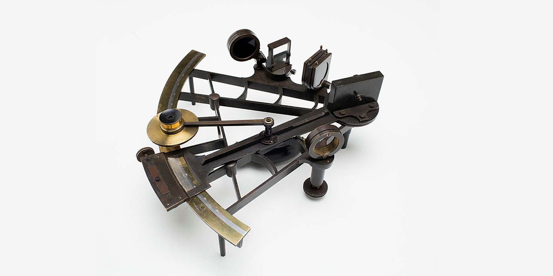
4. The Endeavour was equipped with the latest navigational equipment that was used by Cook to establish global location and to chart accurate maps. Investigate the tools, methods and skills required for celestial navigation in the 1700s.
- View the sextant and octant, navigational equipment that was used by Cook on his voyage. Outline their use in measuring angles in navigation and cartography.
- Conduct research into the first aim of the Endeavour voyage, to record the Transit of Venus, the time it took the planet Venus to cross over the sun. The results of which would enable the identification of longitude. Access the museum resources to explore the scientific investigations that were undertaken by Cook and Charles Green. Conduct scientific inquiry into diffraction and parallax to uncover problems in recording accurate measurements in 1770.
- Watch the video Mapping the Coast (Vimeo 5:59mins) to understand how Cook mapped the east coast of Australia. Record your observations.
- Make an assessment of Cook’s achievements in charting the east coast of Australia by closely examining the maps Cook produced of Entrance of Endeavour River and Botany Bay to current maps that utilise satellite imagery. Extrapolate on the maps produced by Cook throughout his Pacific voyage and the way they were used by Captain Arthur Phillip and the First Fleet in 1788 to locate Botany Bay. Explain the details in the maps such as the location of fresh water and the depths in the bay to construct your argument.
5. Practise geographical and mathematical skills of navigation and cartography by engaging in geometry, maps and GPS. Investigate modern navigation technologies used by modern vessels to navigate the world’s oceans.
6. Reflect on your learning. Can you explain how James Cook and other explorers during the Age of Discovery navigated the oceans and charted the land? What else would you like to find out?