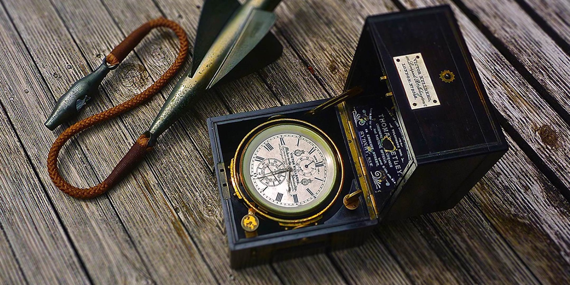
Longitude and my family have a close association, especially with its origin location – 0 degrees. By convention it runs though the London suburb of Greenwich the location of the Royal Observatory, a key institution in the story of longitude Ships, Clocks & Stars: The Quest for Longitude. The Payne family’s boating origins begin here too, a couple minutes’ walk west of 0 degrees is Thames St and Wood Wharf, where our family’s first boatman, my great, great grandfather Frederick Payne lived and worked as a Thames waterman in the 1850s. The same distance to the east and Annandale St was home to his son William, my great grandfather. He was Tudor House pilot on the Thames. Walk down Annandale back toward 0 degrees, turn left and go up Vanbrugh Hill, and The Anchorage No 25 was his final address. It was also home for my grandfather Sidney who was an apprentice in the Aberdeen Line and rose to become a ship’s master, he sailed the oceans. His last sea voyage in the 1920’s on the Coptic took him, his wife and two sons Alan and my father Bill to Australia – 151.20 degrees east. In Sydney, grandfather always wound up his chronometer each day as though he was still living his daily routine at sea. It has stopped now, but the family still have his chronometer, and my brother and I have been lucky enough to have crossed oceans and had to figure out our longitude with a timepiece – it’s nice to know where you are.

Royal Observatory Greenwich. Image: chrisdorney / Shutterstock.com.
East is east and west is west, and never the twain shall meet*
These lines from an 1889 poem by Rudyard Kipling relate to a clash of cultures, but almost since they were published they have been taken out of context and we all relate them to the familiar compass directions. In that context east and west do meet, at one line that goes around the world and forms a circle from pole to pole – a meridian of longitude.
Longitude – it is your location in an east to west direction around the world and it can be determined at any point on earth just by using time. By calculating the difference between the time at your location and the time at another known location you can locate your longitude.
It’s such an elegant solution, two timepieces, the difference between the two times and you know where you are – and maybe we should leave it there.
But that itching temptation to polish things just a bit more and a bit more takes hold. And then we shine too hard and loose the gloss. The first bit of tarnish in this story maybe disappointing- remember that longitude is not a point, it’s only a line running north to south, and you are somewhere on that line.
But things also get interesting. The history of this simple idea being accepted is full of practical clock making difficulties that had to be overcome so they could be reliable at sea. Then there was the competition that came from complicated celestial calculations and some completely mad ideas that were promoted by other interests.
Much of this comes to life in the exhibition – Ships, Clocks & Stars: The Quest for Longitude – but this story adds more, it’s got the problems behind the scenes, material about numbers and concepts, and about things we don’t actually have an object or even a photograph for just yet. Its starts slowly enough, but the pace steps up and in time we end up in space.
It’s such an elegant solution, two timepieces, the difference between the two times and you know where you are.
To set the scene, as time marches on with our timepieces setting the standard, time by the clock does so with a background of unsettling details most would be unaware of. It’s a series of little inaccuracies that are small but over a modest period build up and make time by our mechanical clocks fall out of synch with the day and the sun. Amongst other implications these details can develop into a serious navigational error if they are not accounted for. And for ages timepieces were either annoyingly fast or slow, but we will see at the end of this story how the ability to change time’s duration has been proven to exist.

An octant uses a small mirror to bring two images together to determine latitude at sea by observing the altitude of celestial bodies. An octant that belonged to Captain Neitenstein, circa 1900. ANMM Collection: 00049025.
Along the way there are some intriguing numbers and arithmetic that colour in the history of how we ended up defining and measuring distance and time, multiplied together these two are the longitude factors. On the other hand distance divided by time gives us speed, and we will get there too at the end.
Back at the end of the Renaissance and the beginning of Modern History –
Ships – were square rigged, not very manoeuvrable and hard work, and when they sailed out into the open ocean, they were unable to locate their east/west position with any degree of certainty, and the ever-present danger was being shipwrecked.
Clocks- worked on land, but it needed a genius with perseverance to create the accurate timepiece needed for reliable use at sea.
Stars– the ones that could be seen all had names but there were problems observing the positions of stars, the planets and the sun accurately and then calculating their locations relative to earth to help find your own location on earth was a tedious task.
The navigators of this period had charts with much of the world plotted or being added in as it was being explored and charted, but they could not locate themselves accurately on the chart. When we finish we will have moved forward to the 2000s where it’s come full circle. Ships are amazing examples of engineering and we have spaceships as well, time is down to the millisecond, and we know of invisible stars and galaxies at the end of the universe. We can define our position precisely to the metre as an intersection of two lines given by co-ordinates, but we are now finding that we still have to take care, as we have not yet defined all of our charts with the location of every piece of land and hazard as precisely.
Let’s get some background shaded in first.
References
- *The Ballad of East and West by Rudyard Kipling.