At Sea
Longitude could be considered a relatively modern problem in the story of man’s travels, and universal agreement on how it was to be plotted on a chart was only established in the 1840s. For generations sailors from many seafaring locations had kept largely to the coast and if they were out of sight of land it was only for a short period. From the 15th century onwards locating a ship’s longitude at sea became a significant issue for the largely European sailors making passages on trade routes to and from domains still relatively new to them. They had begun to traverse the major oceans using routes that ventured well out of sight of land and familiar landmarks. They had charts, but locating accurately where they were on the chart when there was no land in sight to relate to presented a problem.
All cultures had their ways of observing the sun, moon and stars and using them in their daily life.
There were reliable ways of determining latitude, the location north or south of the equator. But how far the ship had travelled along a line of latitude was a matter of ‘dead reckoning’, an estimation made from some poor and often unreliable sources of information, and the concern was heightened by the obvious danger of grounding on known but distant continental or island shores, and other hazards that were not even on the chart, and all of this maybe just beyond the horizon.
All cultures had their ways of observing the sun, moon and stars and using them in their daily life. Aboriginal and Torres Strait Islanders also used the sun and moon and read the night sky for direction, and it was knowledge passed on over countless generations, and in addition, helped with their understanding of the changes in seasons. The sky was a calendar as well, marking times’ progress over each year.

‘Kulba Yadail (Old Lyrics)’. The work tells the story of how Torres Strait Islanders learn to read the stars, the moon and the sea to understand the four seasons of Zenadh Kes (Torres Strait). ANMM Collection 00049227. Photograph: Andrew Frolows/ANMM. Estate of the late Billy Missi/Licensed by Viscopy, 2016.
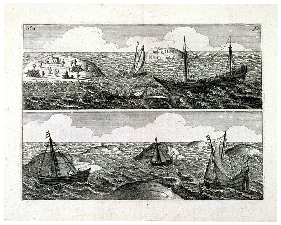
Let’s not forget some of the other passage makers in open waters. It’s interesting to reflect on the Polynesian navigators who did not have a distinct method of working out longitude either. They worked out their position in a different way, rather than seeking a grid of perpendicular lines. They understood latitude from the stars in the sky, which to them was a chart on display every night. By putting themselves directly under a star and heading with the wind along that’s stars line they could keep to a known latitude. They also used estimations of speed to figure out how far they may have travelled, but in addition they had accumulated generations of knowledge from observation of the wind, waves, currents and the environment to pick up signs of land well in advance of it appearing. They were less concerned about always knowing an exact point in the ocean and were able to recognise signs of land even though it was not visible. The knowledge was passed on, and with confidence they sailed their own highways between islands, navigating from the deck with their chart in the sky surrounding them, and the key to unlocking it in their head.
The sailors of the early modern period did not possess these observations and abilities to the same degree or with the same confidence, especially in unfamiliar territory. The Renaissance brought mankind many steps forward in technology and sailors were becoming more reliant on man-made instruments linked to tables of calculations, along with charts divided by grid lines and points marked by intersections, and their approach to the longitude problem was to seek a solution that was increasingly worked out below decks with pen and paper.

The 1848 edition of 'A Complete Epitome of Practical Navigation' by John William. ANMM Collection: 00027116.
A number of proposals were put forward to locate longitude, and the clearly mad ones such as lightships anchored at close intervals across oceans, or the more satirical idea with barking dogs were easily dismissed. It was possible in theory and in practice on land to estimate longitude using tedious and complicated calculations from celestial observations of Jupiter’s moons, but this was not practical at sea. Other celestial based solutions were considered, but these could all come up with potentially unreliable results even assuming no mathematical mistakes were made. A favourite method in many quarters was Lunar Distance, relying on observations of earth’s moon, and it was necessary to know time for this method too. Work is the thief of time says the proverb, and much time was stolen by the decades of work it took to understand the moon’s pattern of movement to a point that the predictions could be considered even reasonably reliable. As well, until the octant and sextant were refined further, it was impractical aboard ships to accurately measure the angles needed for the calculation.
In parallel with this determination to use the stars or the moon, the solution through the difference in time was well enough known. It had been brought up in the early 1500s, and periodically came to the surface again and again. The easier part was telling the time where you were even without a timepiece. This could be done with existing technology – by observing the sun and noting when it was ever so briefly at its highest point in the sky through a series of observations either side of midday gave you midday at your location with quite reasonable accuracy. The problem was the second element needed, carrying the time of day from another location with you. What was needed was a timepiece that remained accurate to the second for a very long period- many months was desirable, but a couple of years was the ultimate goal.

Named because its arc is equal to one sixth of a circle, a sextant is actually capable of measuring angles up to 120 degrees. It was this feature which made them particularly useful when attempting to determine longitude using the lunar distance method. ANMM Collection: 00006711.
The solution came in a series of timepieces designed and built by John Harrison, and one of the highlights of the exhibition. He had to overcome a wide range of practical problems due to materials, the mechanical actions of the machinery, the marine environment, and the outside influence of the ship’s rapid and seemingly random movements- all aimed at a timepiece that maintained a regular, even beat for each second. His focus on the problems that temperature changes caused to crucial metal parts was just one area where his solutions gave big improvements to the accuracy of timepieces.
Meanwhile, as he perfected his clock making approach both the tables and instruments needed for Lunar Distance were coming together in a usable manner as well, and the competition between the two was exacerbated by the 1714 Longitude Act that had offered a substantial reward for an acceptable solution. Along with the fortune waiting to be claimed were the inevitable politics, personalities and pride as people fought to be the one who got the reward. All these elements served to make the route to the final solution contorted, poisoned and frustrating for all involved.
In the face of this Harrison persisted and perfected over five decades. The first three of his timepieces were bulky and the two that were completed came closer to the accuracy wanted than had been achieved before but still had fundamental flaws. His timepiece from 1759 known as No 4 was the breakthrough instrument and in many ways it was really a big watch. Its size and accuracy and the subsequent nautical timepieces that followed, known as chronometers from the Greek god Chronos who had a strong connection to time in their mythology, finally made time differences a practical method for calculating a meridian of longitude. The ships had their clocks- and the clocks were set to one star- the sun.


A chronometer from the 1860s - Two day chronometer by Hewitt & Sons, London. ANMM Collection: 00039801.
MERIDIANS
Meridians are relatively easy to visualize and understand. They are the circles around the earth passing through the North Pole to South Pole that allow us to divide the parallel lines or circles of latitude into equal divisions. They look like the lines dividing a peeled orange into segments. These are also called great circles and each meridian of longitude is the same diameter, whereas circles of latitude decrease in diameter away from the equator.

A Terrestrial hand globe made by Newton & Son, 1851-1857. ANMM Collection: 00045821.
On charts however, the circles of latitude and longitude often end up being projected or drawn out as a straight line. On charts covering a small area these straight lines are only a very tiny portion of the overall circle they are part of. In fact they represent a curved arc of the bigger circle.
By convention the position of any point on the Earth is located by its meridian of longitude and its parallel of latitude. Each meridian is perpendicular to all circles of latitude. As noted, each meridian is also the same length and equal to the circumference of the Earth, as each meridian is a great circle dividing the Earth into two equal hemispheres.
The term “meridian” comes from the Latin word for midday meridies, highlighting again the connection between the sun and how it can give an exact time at one point each day. When the sun crosses directly above each meridian midway between the times of sunrise and sunset, it is midday for that meridian. Midday became a datum as it appeared to remain constant, whereas the length of the day between sunrise and sunset quite obviously varies throughout the year, so those times are also variable. Midday can be determined each day and timepieces can be checked against the time of midday and reset or a correction can be made.
Midday became a datum as it appeared to remain constant.
A datum meridian is needed as an origin to work from, and to be universally manageable that datum needs universal acceptance.
In 1851, (Sir) George Airy began observing at Greenwich with a new transit circle, an accurate telescope that is operated in a plane aligned north south. It is used to locate the time at which a star crosses the meridian, as it travels from East to West across the sky, and the angle of the star above the horizon. From these measurements the transit of the sun and other stars across the meridian can be used to set the clocks at an observatory.
From then on, this instrument defined the prime meridian at Greenwich, replacing a previous one used (with other instruments) by his predecessors. The meridian defined by Airy’s transit instrument also became the prime meridian for the UK (and the basis of national time). This prime meridian passed through the Royal Observatory, Greenwich, which had been set up much earlier to begin the task of charting the moon and stars and help resolve the Lunar Distance method.

The chart shows latitude and longitude lines, but being French, here the datum meridian for longitude passes through Paris. ANMM Collection: 00008707.
In October 1884 delegates from 25 nations met in Washington, D.C., USA, for the International Meridian Conference, and here the Greenwich Meridian was recommended as the official prime meridian of 0 degrees, and in time accepted as such around the world.
For decades the prime meridian was then understood to pass through the Airy Transit and its line was indicated with a brass then later stainless steel strip in the courtyard, where millions have had their image taken. From late 1999, it has been marked by a green laser shining north across the Thames and London at night.

The Prime Meridian at Greenwich. Image: Andres Rueda / Wikimedia Commons.
However, our modern Global Positioning System (GPS) receivers that work to the earth’s center of gravity as a datum point show the Prime Meridian at Greenwich as a line approximately 5.3 seconds to the west of Airy’s meridian. If you have been there this means the GPS prime meridian runs beside one of the walking paths in the park surrounds just to the east, on the Vanbrugh Park side. The historic Prime Meridian is based on vertical measurements defined by local gravity at Greenwich and this has caused the misalignment of the two meridians. The GPS meridian is now defined so that the time measured from the Prime Meridian using astronomical methods is exactly the same as time measured from the new (GPS) meridian using satellite technology.
A further complication for the meridians and time sets in with the time zones created around the globe, 12 each east and west of the prime meridian. The time zone divisions running north and south are often lines that are related to borders between countries and in many cases borders within them, but they cover about 15 degrees of longitude each. In each time zone the actual time correct to that of the sun occurs on only one meridian.
The 360 degrees division of circles was the obvious means of dividing the equator into meridians, and they were denoted east and west of the meridian from 0 to 180 degrees, rather than running around continually and numbered in 360 degrees.
Now, the point was made earlier that- Midday became a datum as it appeared to remain constant – the problem is it’s not neatly constant. Midday actually moves by 14 to 16 minutes or so either side of an average or mean time. Why? The earth’s motion relative the sun is not a piece of perfect geometry, and this term relative that has crept in a few places now will come back later on. At this point in the discussion it’s enough to know that the earth’s circular orbit with the sun at the centre is not forming a perfect circle, nor is it moving at an absolute constant speed, and neither does it take exactly 24 hours for earth to do one rotation, or exactly 365 days to do one orbit of the sun. In other words there is a host of tiny upsetting things that together become significant and so the fractional parts have to be added in every now and then, such as a leap year with an extra day.
So, having ’aligned’ the modern discrepancy in the location of the prime meridian, the actual time the sun crosses the meridian has its own variation to contend with too, and with some patience and maths the variation can be accounted for, as we will see later on.
Meanwhile – our elegant time solution now has some rough edges, but they can be smoother out.